Srinagar: It seems that winter is all set to make onset over the hilly states of North India. All thanks to the fresh Western Disturbance which is approaching the Western Himalayas around November 13.
Weather across Jammu and Kashmir, Himachal Pradesh and Uttarakhand has been almost dry for last many days. Though on and off Western Disturbances were travelling across Western Himalayas but they were feeble in nature and thus, failed to give any weather activity over the region.
First spell of winter rains in Punjab, Delhi, Hary… Dense fog to persist in Punjab, Haryana, UP, Rajas… Pollution in Delhi Live Update: NGT questions the … Delhi Pollution: Air quality to start improving no…
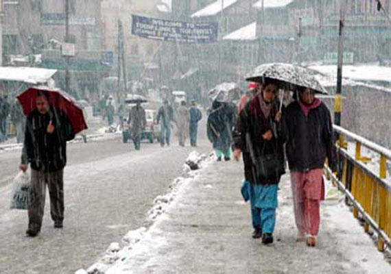
Now, we are again expected a Western Disturbance to affect the region very soon, which is likely to be the first active weather system of the season that would give rain and snow. Initially, we can expect light rains over Jammu and Kashmir on November 13.
November 14 onward, we can expect rains to intensify over Jammu and Kashmir and also cover parts of Himachal Pradesh. In fact, the higher reaches of these mentioned regions may receive season’s first snowfall activity.
With this, both maximum and minimum temperatures would also start dropping across Jammu and Kashmir, Himachal Pradesh and Uttarakhand. The night temperatures are already settling below 10°C but day temperatures will now witness a major fall.
Now, the frequency as well as intensity of Western Disturbance will also start increasing. Not only this, they will now start travelling in the low altitudes and impact the weather over the hilly regions more often.
Western Disturbances are primarily responsible for setting in the winter season over North India. Once these active systems approach the region, they usually stay for 1-2 days and give spells of rain and snow of varying intensity.